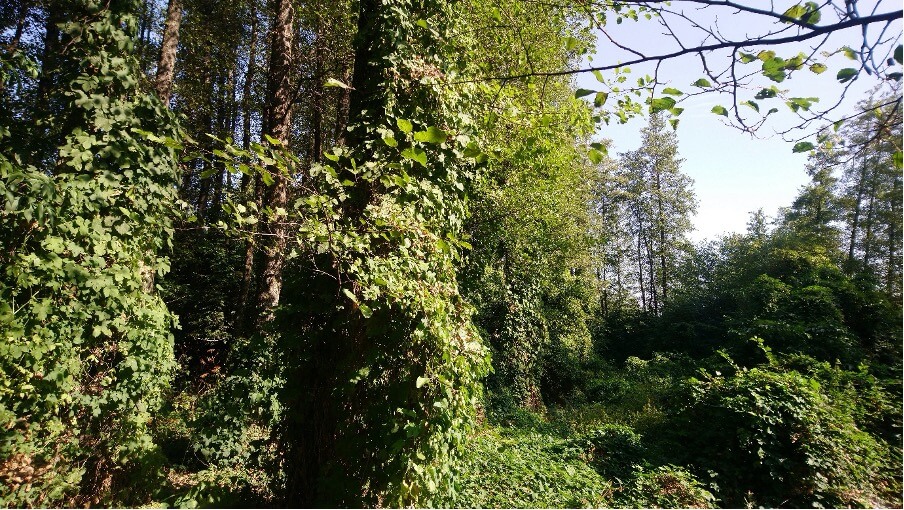
Riparian zones are areas/surfaces located in the immediate vicinity of watercourses, regardless of whether these are streams, rivers, or lakes, where periodic or occasional flooding occurs. These forest communities, together with the watercourse alongside which they develop, form an essential part of the structure and functioning of coastal/riparian areas. Riparian zones encompass not only the active channel of the water body (stream, river, or lake) but also the exposed areas near these specific “water bodies,” as well as the flooded areas situated above and in close proximity to the water’s edge. They are characterized by the presence of specific flora and fauna species, whose structure depends on the natural hydrological regimes that reflect the particular landscape.
These forest ecosystems are important because they provide high biomass productivity, support the lives of numerous species (high biodiversity), and offer a range of ecological services, including flood and soil erosion control, removal of nutrients from agricultural runoff, mitigation of pollution effects, and serve as habitats and refuges for birds and mammals.
Impact on riparian forests from human activities (encroachment of agricultural lands into natural alder forest habitats)
In the absence of human activities and disturbances, primarily due to land-use changes, riparian vegetation communities support numerous functions, including stabilizing the bank by reinforcing the soil with their root systems, accumulating sediment deposits in flooded areas during periods of high flow, facilitating water flow through sediment deposits, and providing a substantial supply of wood material that significantly influences channel complexity and the characteristics of in-stream habitats.
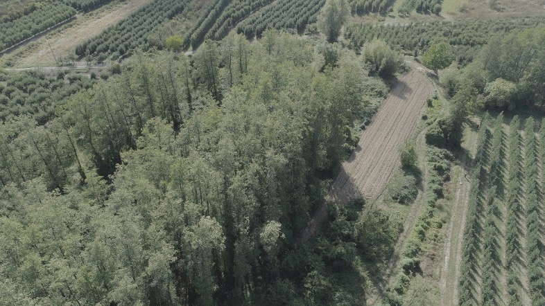
Forests in the Lake Prespa region are well represented in terms of their coverage — 91E0 Alluvial alder forests cover approximately 130 hectares (0.65% of the total surveyed area), while willow or gallery forests 92A0 Salix alba cover 491 hectares (2.47% of the total surveyed area). However, these forests are not distributed in one continuous forest belt but are found in a large number of different forest patches, indicating their relatively recent origin (mainly following the retreat of the lake shore at the end of the last century). Unfortunately, the forests with mature and old trees (near the village of Ezerani) have been almost completely destroyed. Connecting these forest patches through continuous natural succession would result in the establishment of larger forest stands characterized by higher ecological value (especially as wildlife habitat).
Older alder trees in Prespa develop and grow on alluvial and sandy soils by the lake and mainly represent remnants of former old alder forests. About 42% of the total alder forest presence (130 ha) is recorded within the boundaries of the “Ezerani” Nature Park, which amounts to 54.52 hectares, consisting of 88 smaller or larger forest patches.
The Macedonian Ecological Society (MES) is a civil society organization actively working in the areas of ecology and environmental protection.